Outside Maps provides multiple mapping sources for you to explore either from the comfort of your own chair or outside!
Outside Maps provides accurate waypoint navigation functionality.
Outside Maps provides a variety of ways in which you can accurately fix your position.
The Outside Maps user interface is designed to be unobtrusive and simple.
The buttons present on the map screen are the most commonly used for that interface giving you quick access to changing map sources, centering on your current location and opening the navigation interface.
Your current location is shown by a blue dot. Your current direction is shown by the lines radiating from the blue dot.
If you tap and hold on the map screen, a set of options will appear enabling you to add waypoints and update your current location (if GPS is disabled).
Switching between map sources in Outside Maps is easy. Tap on the Map Sources button and select the one you want from the list. The new maps will load for the same location as currently displayed.
The primary mapping is modern Ordnance Survey but historic Ordnance Survey data, aerial imagery and various OpenStreetMap mapping is also available. There are also hill-shaded options for UK terrain visualisation.
We have included special interest maps from Thunder Forest and more artistic mapping from Stamen.
Tapping on the Navigation button on the map screen will overlay a heads-up display showing directional and positional information.
To dismiss the navigation heads-up display, tap on the Navigation button you used to open it.
From the top-down, your compass direction is indicated by the arrow. If you are navigating to a waypoint, the waypoint information will be populated and the arrow should be pointed directly up to navigate to the waypoint. The compass directions will rotate around the arrow in this case. To stop navigating to a waypoint, tap the "X" in the circle.
Your current location is displayed under the compass in a variety of coordinate systems. The "W3W" uses what3words. This does not update in real-time but will update if you tap on any of the words.
The accuracy numbers are horizontal accuracy and vertical accuracy respectively. If the horizontal accuracy number is large, your position may not be reliable.
Outside Maps enables you to create waypoints inside the app by tapping and holding on the map screen. Waypoints created in this way can be dragged around. If you tap on a waypoint, options appear enabling you to navigate to that waypoint amongst other things. To disable "draggability", select "Goto Waypoint Page" and switch "Draggability" off.
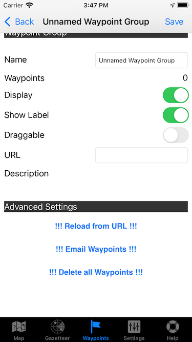
Waypoints can also be imported via GPX files. Tap on the "Waypoints" tab to access this functionality.
To add a new group, tap "Add" and select "Blank Group". Then tap on the circled "i" Information icon to access the waypoint group information. You can type in the URL at which the GPX file is located. You should then tap "Reload from URL" to actually pull the waypoint data into Outside Maps.
Once loaded, the waypoints will be displayed on the map.